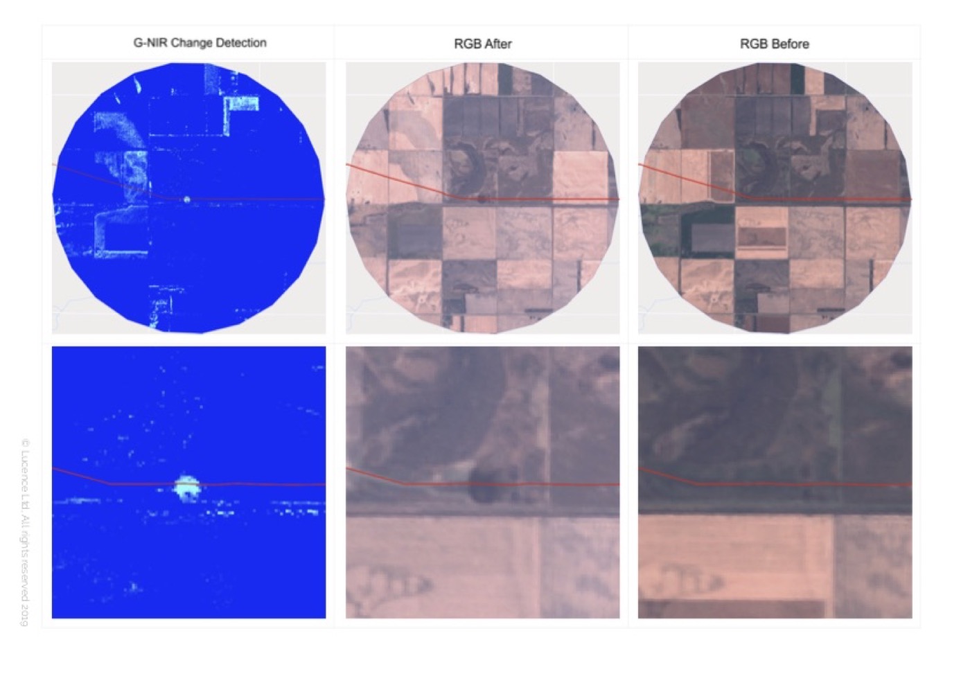
Oil spill monitoring uses paired satellite or aerial imagery to flag new surface disturbances.
The workflow compares RGB scenes before and after an event with a green–near-infrared (G-NIR) change-detection layer, so new features — including potential spills and related land or water surface changes — stand out against the background landscape.